Imagine a city where you were never far away from your favorite thing to do. For some, this would be roller skating, ax-throwing, local gaming conventions, and so on. Luckily, for those who love hiking trails, no place in the western United States is quite like Phoenix, Arizona.
The Phoenix area is home to many popular hiking trails. So many of these are fit for both experienced hikers or newbies, alike. The best part of these trails is that they are all so easily accessible. You are never far from a great trail with a parking lot and beautiful views waiting just for you.
If you are an avid hiker who loves long hikes, or if you’re looking for a more moderate hike in the area, here are some great places to look!
Tom’s Thumb Trail
This trail sits on the north face of the McDowell Mountains and has something for everyone. Experienced hikers enjoy the 1,300-foot rise in a trail that's only around 2.5 miles long. Rock climbers can enjoy granite rock formations for rappelling, and the less-experienced can find guided tours.
This trail got its name from the Arizona Mountaineering Club, who named it after the first of their club’s members to climb it: Tom Kreuser. Most people will recognize it because of the distinctive butte formation that points to the sky like a massive finger.
Nature-lovers can see birds nesting during the right seasons, coyotes, and amazing natural rock formations!
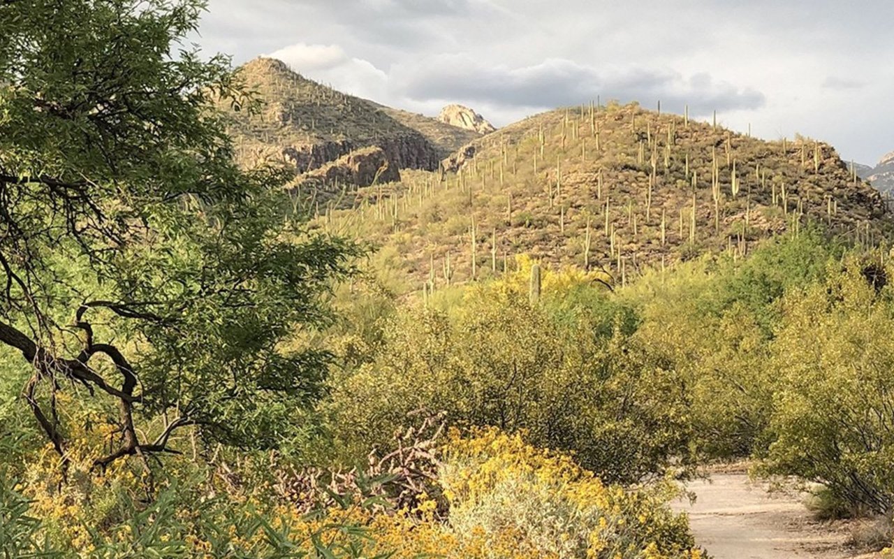
Wind Cave Trail
This moderate-rated trail winds its way up the slopes of Pass Mountain. Here, one can find beautiful vistas and warm, gentle breezes across the mountain faces. The 3-mile hike and 800-foot elevation gain are great for a workout, and downtown Arizona can be seen from the top of the climb. Near the end, there is also a cave you can shelter in for a rest if you like!
This trail does tend to get very hot if you try to hike it during the day. Locals recommend starting your hike there early in the morning (6 am), or late in the evening, or at night.
Treasure Loop Trail
The Lost Dutchman State Park is named after a local legend of a lost gold mine. Whether or not the gold has ever been found may not be known, but despite that, this park has one of the most popular trails in the greater Phoenix area. Treasure Loop Trail winds its way through the Superstition Mountains. Its 2.4-mile run can be run in around 1.5 hours and is very well maintained. Its accumulated gain is only around 500 feet.
During the spring, the trail is surrounded by wildflowers of all varieties. Poppies, yellow brittlebrush, globemallow, and lupine are all present, as well as many other species of flowers. It is particularly beautiful after winter rains. Many kinds of natural wildlife can be seen—from birds and bees to coyotes and deer—and the rock formations are beautiful!
San Juan Lookout
For a more low-key hike, check out the San Juan Lookout in South Mountain State Park. Because it doesn’t have the higher elevation of other trails in the area, it doesn’t receive as much traffic. Despite that, this short, two-mile hike is an amazing one. The San Juan Lookout offers a view of a beautiful valley and the more rural areas of the mountains and city. It can be accessed by either the roads or by taking the National Trail.
This trail has beautiful riparian trees that provide a moderate amount of shade and winds its way through cactus groves. Near its end, a beautiful view of the Ma Ha Tuak Range can be found that will take your breath away.
Pinnacle Peak Trail
This trail is a bit of a misnomer: it doesn’t actually reach the peak of its mountain. Pinnacle Peak is a 4-mile hike that reaches an elevation gain of 1,000 feet. It isn’t a round-trip, but instead just a straight trip that dead-ends at the two-mile mark. No dogs are allowed on this trail, and there are no facilities along the way, but it is a relatively easy walk.
Despite the drawbacks, this trail offers an amazing view of Camelback Mountain, the McDowell Mountains, and most of the Scottsdale area. You won't be disappointed.
Piestewa Peak Summit Trail
Another of the more popular trails is the Piestewa Peak Summit Trail. Located directly inside the city, it is a popular location for both locals and tourists. Originally called Squaw Peak, it was renamed later in honor of a Native American war veteran.
This trail will absolutely destroy you. It is a 2.4-mile hike with a 1,200-foot elevation gain in the first 1.2 miles to the top. Some parts are old, eroding concrete steps, barely noticeable natural steps, gravel paths, rocks that you need to climb on your hands and knees, and steps cut right into the stone of the mountain. In fact, the last major climb is often mistaken by many as the end because the next few steps cannot be easily seen. Also, a major problem with the trail is the lack of visual progress. Yes, the stuff below you shrinks quickly, but it's hard to gauge your progress toward the summit.
Despite the grueling trip, one that will test both new and experienced hikers, the reward is incredible. You will receive an amazing, full view of the city below from the second-highest peak in the Phoenix area. The trail is hard, but you won't regret sanding at the top, no matter how hard the climb was.
Because of the popularity of the trail, many locals prefer to go here around dusk. The nighttime trip back is very peaceful, and won’t be full of tourists.
Double Butte Loop Trail
For hikers that bring children or dogs, the Double Butte Loop trail is perfect. It is 2.5 miles long, but only takes about an hour’s hike because of the 70-foot elevation gain. It is quite popular, though, because of the Papago Buttes, ancient formations that are nearly 20 million years old!
Here, you can climb on some of the rock structures, where you will find some freedom from the crowds that may gather. Many of the trails are unmarked, so you can wander all over the park, just make sure you don’t get lost. Down some of the unmarked trails, you can find impressive views of the highways, butte formations, and even an old amphitheater built in the 1930s!
No matter how far down any of the unmarked trails you journey, you are never too far away from the parking lot. You can also see lots of natural wildlife here.
Camelback Mountain
Barely a 20-minute drive from downtown, Camelback Mountain has a duo of very difficult trails to climb that lead you to the peak. Echo Canyon Trail and Cholla Trail are laborious and subject to high temperatures. Experienced climbers recommend that you bring plenty of water.
It is a 2.5-mile climb of nearly 1,450 feet. Also, the last half-mile of the climb is a scramble up the rocks to the summit.
As these are the most popular trails in Phoenix, traffic up the trail is heavy during winter months, so consider other paths or come back here at a different time. Due to the strenuous climbs of this mountain, children and dogs are not allowed.
Tips for Hiking Near Phoenix for Beginners
Make sure to pack plenty of water for your hikes, especially during the late summer months. Also, make sure to wear a wide-brimmed hat while on the mountains, as many of these trails have no shade all the way up and down.
Be wary of snakes who like to lay out on hot rocks!
Be prepared to street park your vehicle, as many of these trails have smaller parking lots.
Above all, remember to relax and enjoy the climb!